
In our next Blaze The Trail feature, we take on Chestnut Nature Park, with its jungle terrains, steep slopes and forest creatures
Though our Live Better month is long over, we at Honeycombers are always all about the #fitlife. From superfood and healthy power lunches, to hitting the gym and bootcamps on a regular, we’re always looking for new ways to keep ourselves in shape. Our top pick for feel-good fitness? Hikes.
In this month’s Blaze the Trail feature, we took to the jungle terrain of Chestnut Nature Park. Located on the Eastern end of Chestnut Avenue near Bukit Timah and Bukit Panjang, the park isn’t new to the scene. But with the recent opening of its Northern section, the park is now the largest in Singapore at 81 hectares, and encompasses a space larger than 110 football fields. Its biggest highlight? It’s the only park with separate loops for hikers and bikers. While it may be a bit of a drive to get to, we promise it’s worth the trouble – here, you’ll trek along heavily forested areas and winding slopes and see exotic flora and fauna. Bonus: It’s easy to keep track of your accomplished trek with distance markers at every 100 metres. Time to lace up those sneakers and get trekking!
Want more adventure stories? Check out our guide to South East Asia’s best hikes and adventure activities.
Begin at Chestnut Park carpark
The first thing to take note of is where to start your hike. If you’re driving or taking a taxi there, take note that the address of the carpark is 105 Chestnut Avenue (this is crucial, as three out of four of us on the hike lost our way). Otherwise, public transport users can head here for directions. Aside from a bicycle kiosk, the carpark is the only place you’ll find the only toilets in the park as well as water coolers to rehydrate.
Ready to start your hike? Simply follow the signs to get to the start Northern and Southern Loops.
[hc_component id=”130176″]

Hike the Northern Loop
First things first: The Northern Loop is relatively easy to hike. This side of the park has little slopes, and boasts rugged pathways, as well as ones lined with stones. Look out for the large log over the river near the start of the loop – while we wouldn’t suggest using this as a real bridge, it makes a great shot. Also found here are shelters of assorted sizes; these kept us cool and dry when a heavy downpour struck.
We’d also strongly advise following the pathways. At certain sections, you’ll find signs indicating restricted areas with potential live firing shots on your left and right. Other quirky things to look out for: a random toy snake wrapped around a tree (we’re still puzzling over that), and a clearing which looks out onto the biking trail so you can watch stunts in action.
[hc_component id=”130177″]
The more exciting trail: The Southern Loop
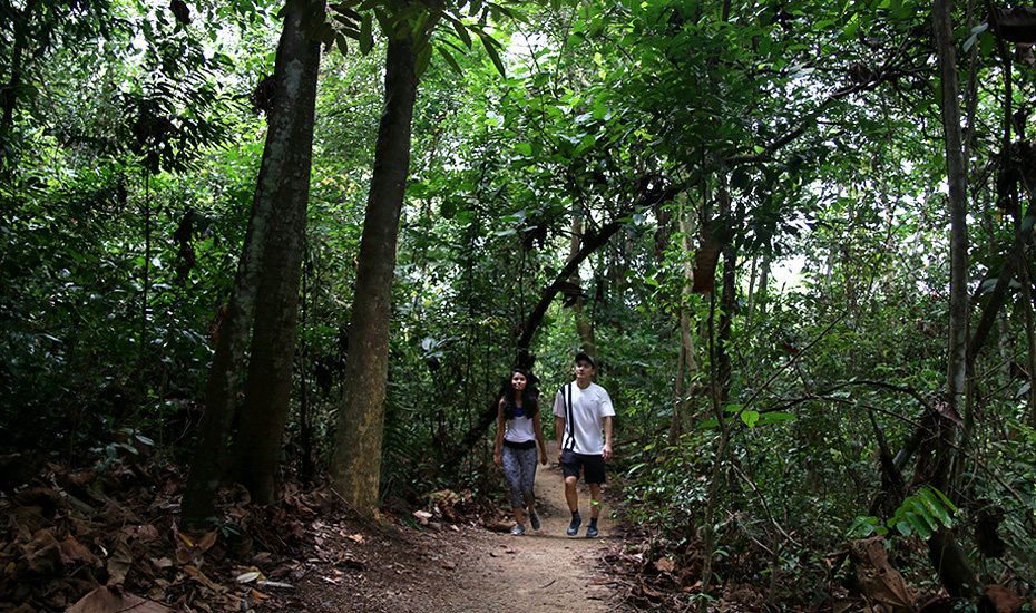
Despite its short 2.1 km distance, The Southern Loop is a lot more exciting to hike. Instead of the similar-looking jungle areas you’ll find at the Northern Loop, this trail takes you through varying terrains and landscapes, and requires you to hike winding slopes overlooking the expressway. It’s worth the climb though – on your trek, you’ll spot a green lake, fallen logs covered in wild mushrooms, trees with exotic fruits like figs and jackfruits , and if you’re lucky, a squirrel or two on the hunt for food. A highlight we swooned over was a pathway sheltered by a beautiful forest canopy, with branches growing towards each other to resemble an arch. Also don’t forget to snap pics of the loops’ only clearing. After a primarily sheltered hike, the field of grass is the perfect place to catch a little sun. Once you’re finished with this loop, you’ll find yourself right back to where you started – from here, a short walk takes you back to the carpark (and the rest of civilisation).
Check out our other hiking trails in Singapore guide, and full-on walkthroughs for The Southern Ridges, and Coney Island.